

An efficient drone for Survey & Mapping
(3D Modeling and LiDAR Survey)
6 KG VTOL | X-Configuration Quadcopter
Technical Specifications
- Operational Range : Up to 8 KM
- True Endurance : 60 Minutes
- Take off Weight : <=6kg
- Dimensions: 62 X 62 X 29 cm
- Operational Altitude : 120 m
- Max Operating Altitude : 4500 m
- Cruise Speed : 8-14 m/s
- Max Speed : 14 m/s
- Operating Temperature : -20° to 60° C
- Front & Back Obstacle Avoidance
- Day & Night Reconnaissance
- Dual redundant GPS system

Unique Features
- Unique design with center of gravity
- Compact size
- Upto 1.5 kg Payload capacity
- Dual Battery System for safety
- Front & Back Obstacle Avoidance
Optional Capabilities
- Live Streaming capability
- On Board Edge Computing and AI/ML
- Deep integration of AI & geospatial analytics
Multiple Swappable Payloads For Survey and Mapping
- RGB Camera upto 24-150mp
- LiDAR Sensor
- Oblique Camera for 3D City Model
- Multispectral and Hyperspectral – Agriculture
- Thermal with RGB camera – for Power
- Magnetometer – Geophysical Survey
Multiple Swappable Payloads For Defence
- Thermal and IR Camera
- Megaphones
- Long range surveillance camera and sensors
- Weapons and Ammunitions
- Droppable delivery boxes

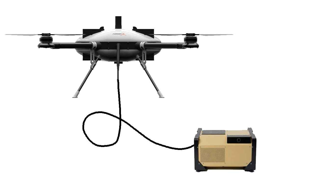
Threaded Aerial Vehicle
Technical Specifications
- Operational Range : Up to 2.5 KM
- Actual Endurance : Up to 20 hours
- Take off Weight : Up to 8 KG
- Dimensions: 85 X 85 X 29 cm
- Operational Altitude : 100 m
- Max Operating Altitude : 3500 m
- Wind resistance : 12 m/s
- Operating Temperature : -20° to 60° C
Defense Applications (TAS)
- Perimeter & Base Security
- Temporary Communication Node
- Tactical Observation & Reconnaissance
- Force Protection in Convoys
- Drone Jammer & EW Platform
Civil Applications (TAS)
- Event Surveillance & Crowd Monitoring
- Disaster Management & Relief Operations
- Border & Coastal Surveillance (Civilian Agencies)
- Urban Traffic & Public Safety Monitoring
- Media & Communication Relay
Infrastructure Applications (TAS)
- Construction Site Monitoring
- Power Line and Grid Inspection
- Oil & Gas Facility Surveillance
- Smart City Surveillance Networks
- Telecom & Signal Relay Station
Ready to Elevate Your Perspective?
Discover new possibilities and redefine what's possible from above.
Learn More & Get Your's